It’s no secret that Yellowstone National Park is a natural wonderland, and hiking is one of the best way to experience it. With over 900 miles of trails throughout the park, there is something for every level of hiker. To get you started, we’ve outlined three of the most scenic hikes in Yellowstone.
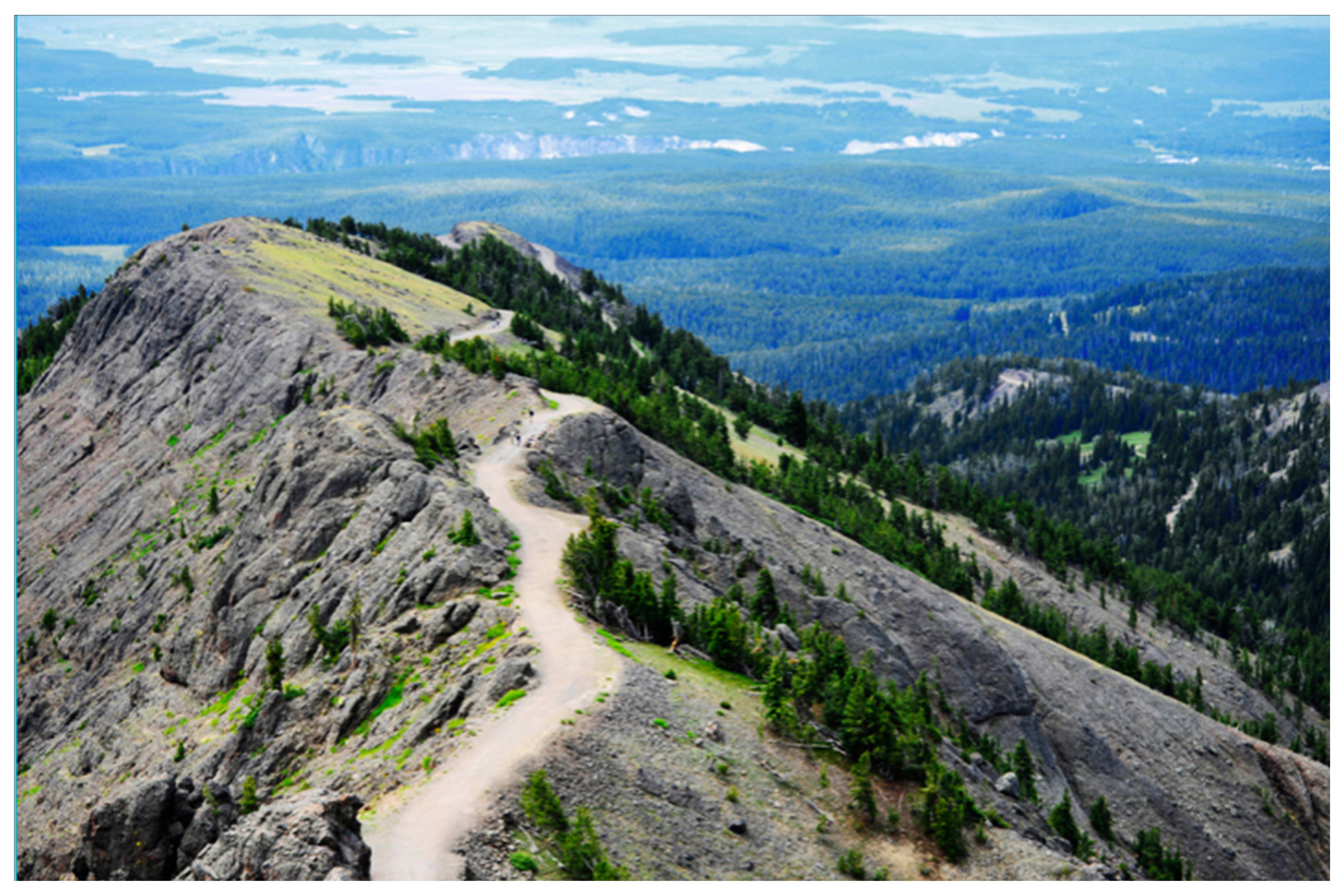
Mt. Washburn
Some say if you can only take one hike in Yellowstone, this is the one. When you reach the top at 10,243 feet, you’ll witness panoramic views that include the Grand Canyon of the Yellowstone, Hayden Valley, the Grand Tetons, Mt. Holmes and possibly even an Old Faithful eruption. The primary firetower in the park sits on top of the mountain, and in addition to offering a fantastic viewing location, the interior houses interpretive exhibits.
The trip up is just as amazing. There are more than 50 species of wildflowers, including pink monkey flowers, yellow violets, blue lupin, yellow balsam root, red paintbrush and violet shooting stars. July is the optimum time to catch this beautiful display of color.
Wildlife is plentiful, including bighorn sheep that live in the higher elevations. This area is also home to bears, with grizzlies becoming more active in the fall.
Mt. Washburn can be accessed two ways, from Dunraven Pass (6.2 miles round trip), or Chittenden Parking Lot (5 miles round trip). The trails were former stagecoach and wagon roads climbing 1400 feet of vertical, and they can be strenuous.
To access the southern trail, starting at Dunravan Pass Trailhead, drive from Canton 4.8 miles on Grand Loop Road toward Dunraven Pass and Tower Falls. The trailhead is on the right in the parking area. From the north side, start at Chittendon Road parking area located between Tower Junction and Canyon Village. This is the easier route and bicycles are allowed.
It is colder and rainier at this elevation, oftentimes with afternoon storms, so in addition to your wildflower book, bring your rain gear!
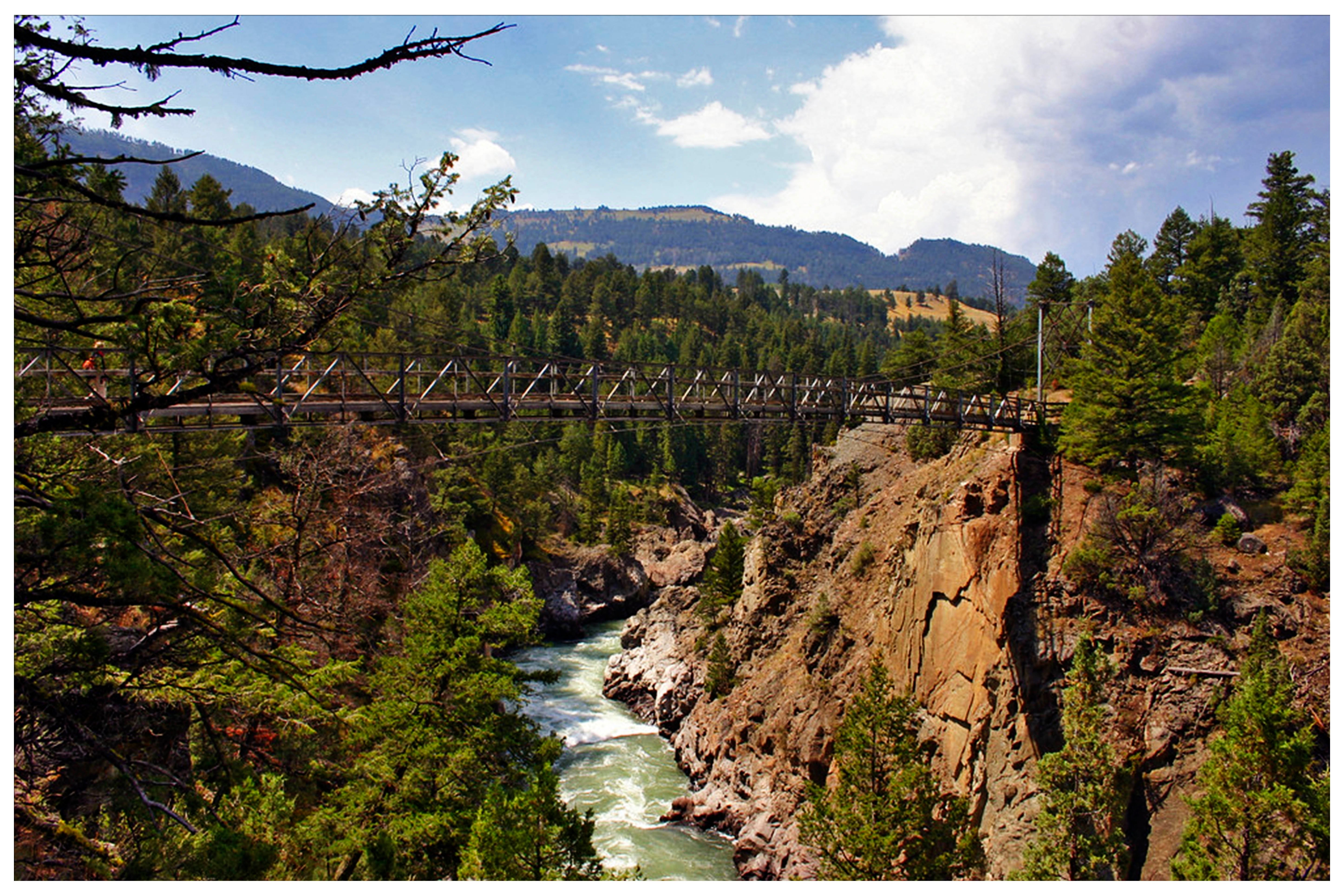
Hellroaring Creek
The highlight of this hike in Yellowstone is the Yellowstone Suspension Bridge towering above the Yellowstone River. The day hike is 6.2 miles ending at the confluence of Hellroaring Creek and the Yellowstone River, which are both popular fishing destinations.
This route is also a major backcountry trail for those who want a longer adventure. For this route, continue to follow the trail to the northern boundary where it connects with Coyote Creek trail and loops around Bull Mountain.
The hike begins with a steep descent down to the bridge, so save your energy for the hike back up. Along the way, you’ll not only find wildflowers, but also exceptional birding including Western Tanagers, Yellow-Rumpled Warblers and Ruby-Crowned Kinglets.
To access Hellroaring Creek, drive 14.5 miles east from Mammoth Hot Springs toward Tower Junction. The trailhead is on the left at the end of a dirt road.
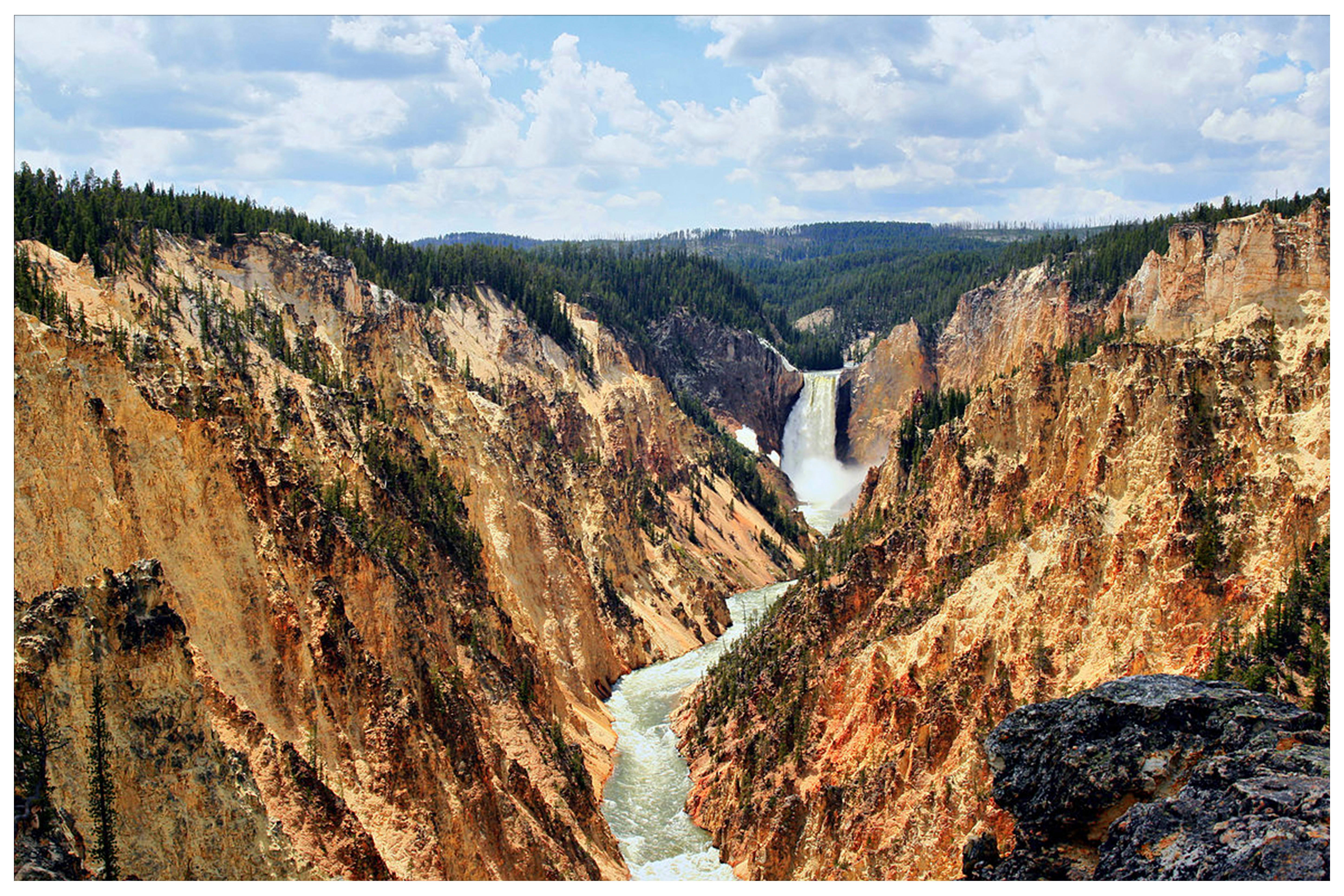
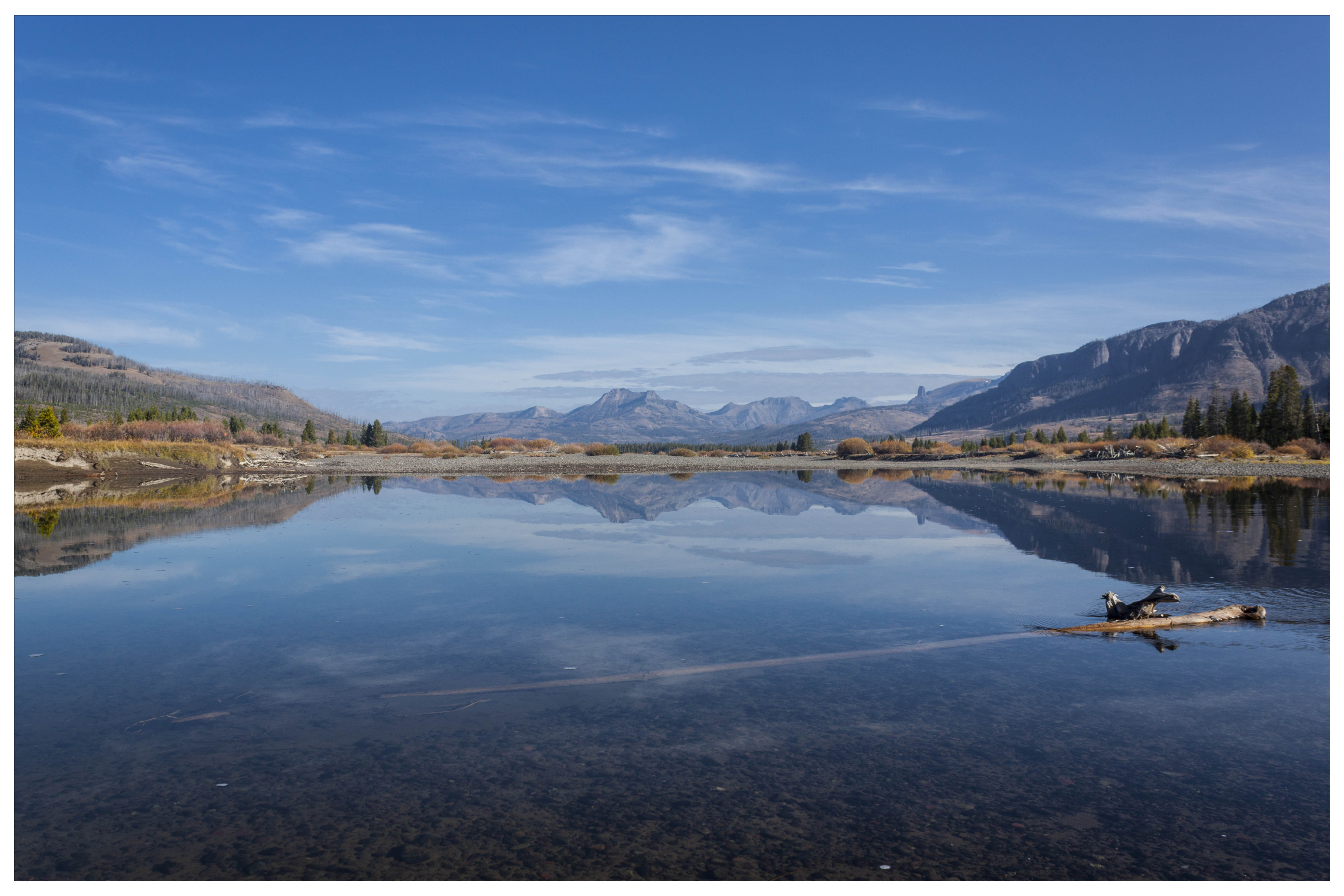
The Rim of the Grand Canyon of the Yellowstone
Known as one of the most spectacular sites in Yellowstone, you can view the Grand Canyon from either the North or South Rim Trails. Both trails include multiple scenic overlooks along the canyon along partially paved or gravel trails. With just 250 feet of elevation change, these hikes in Yellowstone are ones most people can easily trek.
North Rim Trail:
The view from the North Rim is the setting for the first scenic painting (by Thomas Moran) to ever hang on the walls of the White House. Along this trail, you’ll find a postcard view of the Lower Falls, Yellowstone’s biggest waterfall, dropping 308 feet to the canyon bottom.
The trailhead starts in the parking lot of Inspiration Point and is a 6.4 mile hike out and back.
To get there from Tower Junction, head Southeast on Grand Loop Road, at 18.3 miles turn left on to North Rim Drive.
South Rim Trail:
While you can see both the Upper and Lower Falls along this trail, this side of the canyon offers a classic view of the Upper Falls. Starting at the Wapiti Lake Trailhead, cross the road to South Rim Trail, which follows the Yellowstone River just east of the bridge.
You’ll reach a staircase of 328 grated metal steps, which will bring you to the Upper Falls. If you continue on, you’ll head north to the Lower Falls. After you ascend back up, turn left and and head east along a steep switchback which will bring you to Artist Point, giving you a view down the length of the canyon. This trail is shorter than the North Rim, totaling 4.4 miles out and back.
Keep in mind, Yellowstone is home to both black and grizzly bears so always carry bear spray, be alert and make noise along the way. Mosquitoes can also be a nuisance so bug spray is recommended.

If you enjoyed this blog, take a look at some of our other related articles:
- A Guide to In-Town Exploration in Bozeman
- Montana's Creative Capital: Art Galleries In Bozeman, Montana
- Top Ten Hiking Trails Close To Bozeman, Montana

In our never-ending quest to keep up with all things new in Bozeman, we have been producing content for years and can't possibly update every blog when new businesses open or existing businesses close. Please reference the publish date and do your own due diligence when making plans.